Daily forecast | From First Alert Meteorologist Tim Strong
FIRST ALERT WEATHER DAY Saturday - Severe storms early Saturday then windy. Hard freeze Sunday.
AUGUSTA, Ga. (WRDW/WAGT) -
Isolated showers will be possible later in the day. Temperatures will stay below average in the low to mid-60s for highs this afternoon. Winds will be out of the east generally less than 10 mph.
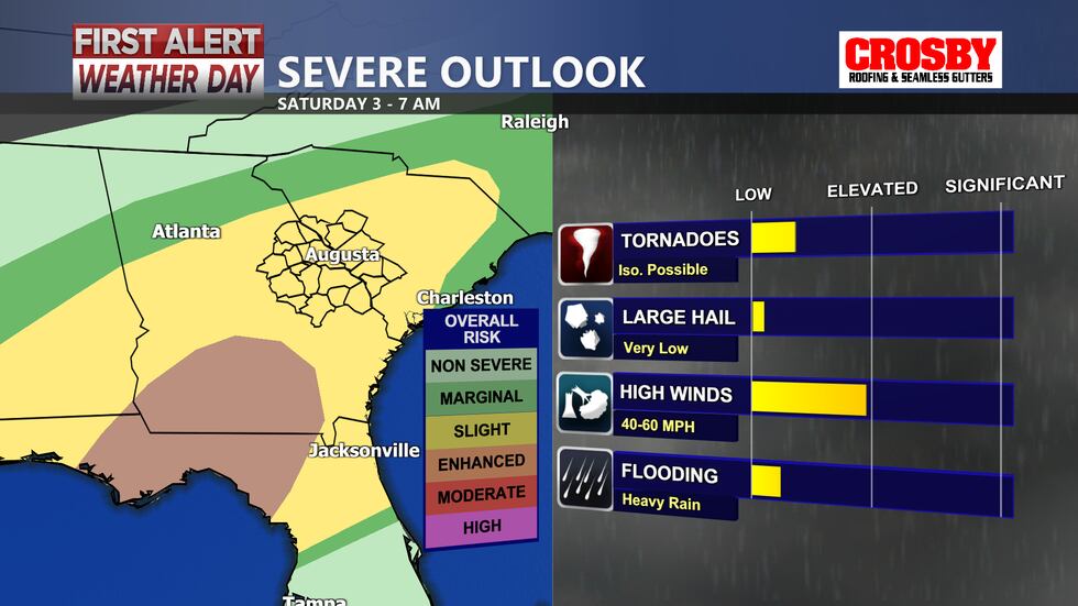
A potent cold front will bring a line of strong to severe storms early Saturday morning between 3-7 AM. Make sure you have a charged cell phone next to your bed before falling asleep Friday night. Tornadoes will be possible with these storms, but the greatest risk will be mainly south and east of I-20. Strong winds are the most likely concern with storms. Storms will be moving east of the CSRA by around 8 am Saturday. The rest of the day Saturday will be very windy with dropping temperatures during the day. Sustained winds will be between 20-30 mph with gusts between 35-45 mph. A few power outages are possible. Temperatures will be near 60 ahead of the front early Saturday but drop to the upper 40s by the afternoon.
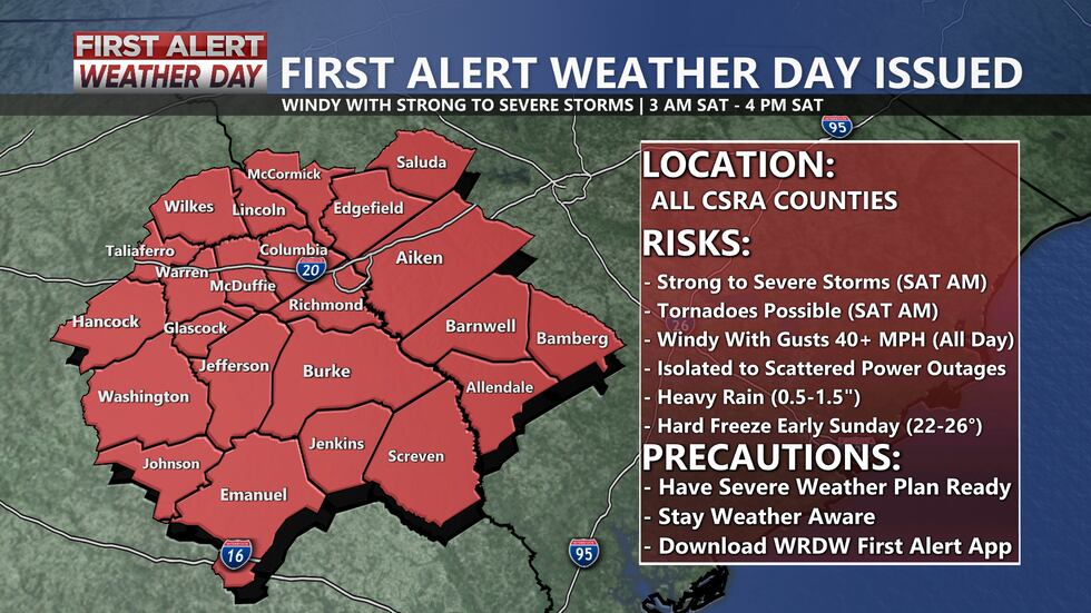
We are then expecting a hard freeze Saturday night into Sunday morning. A FREEZE WATCH is in effect Sunday morning for most of the CSRA. Morning lows Sunday will be all the way down in the low to mid-20s. Protect any outdoor pets and plants! Sunny skies during the day Sunday with winds not as gusty and highs below average in the mid-50s.
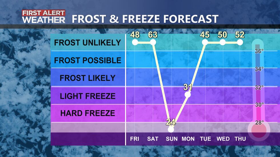
Monday morning will be cold again with lows below freezing in the low 30s. Mostly sunny during the day Monday with highs in the upper 60s.The chance for rain comes back in the forecast by Tuesday.
Copyright 2022 WRDW/WAGT. All rights reserved.


