Weather blog: See a radar analysis of the Bamberg tornado
AUGUSTA, Ga. (WRDW/WAGT) - The National Weather Service in Columbia finished damage surveys around Downtown Bamberg and declared that an EF-2 tornado occurred on January 9th. News 12 has covered the extensive damage in the city. This blog will analyze radar imagery during the storm.
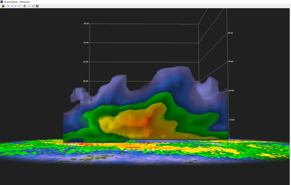
Something interesting about this storm is how the characteristics (or lack thereof) look on the radar. There was not a textbook TVS (tornadic vortex signature), no debris signature, and the tornado was completely rain wrapped. This was a highly sheared environment with little instability. Tornadoes can form very quickly and without much warning in these environments. Many warnings put out this day were severe thunderstorm warnings with tags including wording that - “a tornado could be possible”. This is why the First Alert Weather Team chose to stay with these storms live on-air for several hours.
Below we have a collage of different products used during severe weather events. The top left is the velocity product that measures wind going toward (green) and away (red) from the radar. The top right is the correlation coefficient product which provides a measure of the consistency of the shapes and sizes of targets within the radar beam. Very low values of CC usually mean debris aloft in the atmosphere from a tornado - we call this a tornadic debris signature, or debris ball. The bottom left product is the base reflectivity - the usual radar you see most of the time. The next product, NROT, showed the clearest indication of a tornado signature. NROT stands for Normalized Rotation and it helps paint a clearer picture of the strength of rotation in a storm. The strong NROT signature on radar is what likely led to the National Weather Service triggering the tornado warning just before it hit Downtown Bamberg.
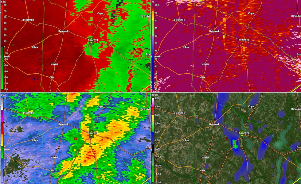
Three of the four products did not show a clear indication of a tornado. The NROT gave us the best indication of rotation and tornado potential for this specific storm. While tracking very strong wind speeds and broad rotation on radar we knew there was the potential for structural damage associated with this storm. A severe thunderstorm warning was issued prior to the tornado forming that included a tag that a tornado could be possible. This is why we kept with the storms all afternoon because the atmosphere was ripe for a quick spin up tornado with these cells. A tornado warning was issued at 2:47 pm as the storm was quickly approaching the city of Bamberg.
There was not a typical debris signature that we would expect to see with this strength of a tornado and that could be due to stronger wind speeds at the surface and how fast the storm itself was moving - close to 60 mph. With how sheared the environment was and how fast the storm was moving - all debris was likely kept low in the atmosphere and never got high enough aloft for the radar beam to see it.
Copyright 2024 WRDW/WAGT. All rights reserved.


