Daily forecast | From First Alert Meteorologist Mikel Hannah-Harding
Hot and mostly dry for July 4th. Few storms possible Friday, but storm chances increase this weekend.
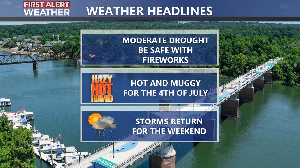
AUGUSTA, Ga. (WRDW/WAGT) - An upper level ridge over the Southeast will bring above average temperatures and mostly dry weather today through Friday morning. Storm chances increase this weekend as the upper level ridge breaks down. Dangerous heat index values near 105°-110° expected the next several afternoons.
The upper-level ridge over the Southeast will intensify today. This will allow highs to reach the upper 90s and heat index values near 105°. With the ridge overhead, storm chances look unlikely, but we’re keeping a 10% chance to cover any tiny shower that overcomes its limitations. Things have been abnormally dry in the CSRA, so be extremely careful with fireworks! Most counties in the CSRA are under a moderate drought.
Intense summer heat and humidity sticks around Friday with highs soaring into the middle to upper 90s. Storm chances look to remain slim with the upper level ridge over the region, but an isolated shower/storm can’t be ruled out - mainly for our Georgia counties. Heat index values will reach 105°-108°. Wind will be out of the south between 5-10 mph.
Afternoon storm chances look higher this weekend as the upper level ridge breaks down. It will still be hot and humid with heat index values near 105° and actual highs in the low to mid-90s. Scattered showers and storms are possible both afternoons this weekend. Morning lows will be muggy in mid-70s. Keep it here for updates!
Copyright 2024 WRDW/WAGT. All rights reserved.


