Daily forecast | From First Alert Meteorologist Tim Strong
FIRST ALERT THU. Milton tracks south of CSRA. Cooler mornings the rest of the week and looking mostly dry.
AUGUSTA, Ga. (WRDW/WAGT) - Northeast wind behind the front over the next few days will keep cooler than average temperatures in place through Friday - more seasonal by the end of the weekend.
Cloud cover from the outflow of Milton will filter into the region today and keep our skies mostly cloudy. We are expecting to stay dry despite the cloud cover most of the day. Highs will be cooler than average in the mid to upper 70s. Wind will be out of the northeast between 5-12 mph.
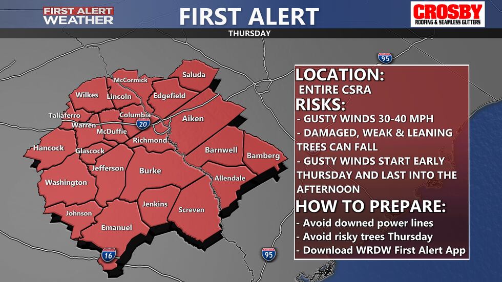
Wind will be elevated Thursday and a FIRST ALERT will be in effect for the entire CSRA. as a tight pressure gradient develops between high pressure to our north and Hurricane Milton to our south (low pressure). Wind will be sustained out of the northeast between 10-20 mph, but gusts could rise to around 30-40 mph - which is concerning with so many weakened trees in our area from Helene. PLEASE AVOID LEANING OR WEAK TREES DURING THE DAY THURSDAY. Highs will remain below average in the mid to upper 70s under mostly sunny skies. Wind will start to gradually decrease late Thursday.
Friday could still be a little breezy with northeast wind between 10-15 mph and gusts near 20 mph. Sunny skies expected during the day with chilly morning lows in the upper 40s and mild afternoon highs in the mid-70s.
The weekend looks gorgeous with morning lows cooling off to the mid and upper 40s and afternoon highs near 80. Wind will be light and variable Saturday as high pressure centers over the region. Wind will turn out of the southwest Sunday as high pressure retreats to the east.
Keep it here for the latest and most accurate updates!
Copyright 2024 WRDW/WAGT. All rights reserved.


