Daily forecast | From First Alert Meteorologist Mikel Hannah-Harding
FIRST ALERT TONIGHT - THURSDAY, WIDESPREAD HEAVY RAIN POSSIBLE 2-4″+, HIGHS REMAIN ABOVE AVERAGE.
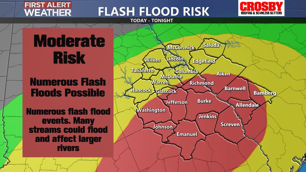
AUGUSTA, Ga. (WRDW/WAGT) - Rain chances continue to elevate this evening ahead of a cold front slowly approaching our region. Tropical moisture will be present which will further enhance rain chances. There is a Slight to Moderate Flash Flood Risk through Thursday morning. Widespread 2-4″+ of rainfall is possible. Isolated accumulations 4-6+” look possible also. A FIRST ALERT has been issued as a result.
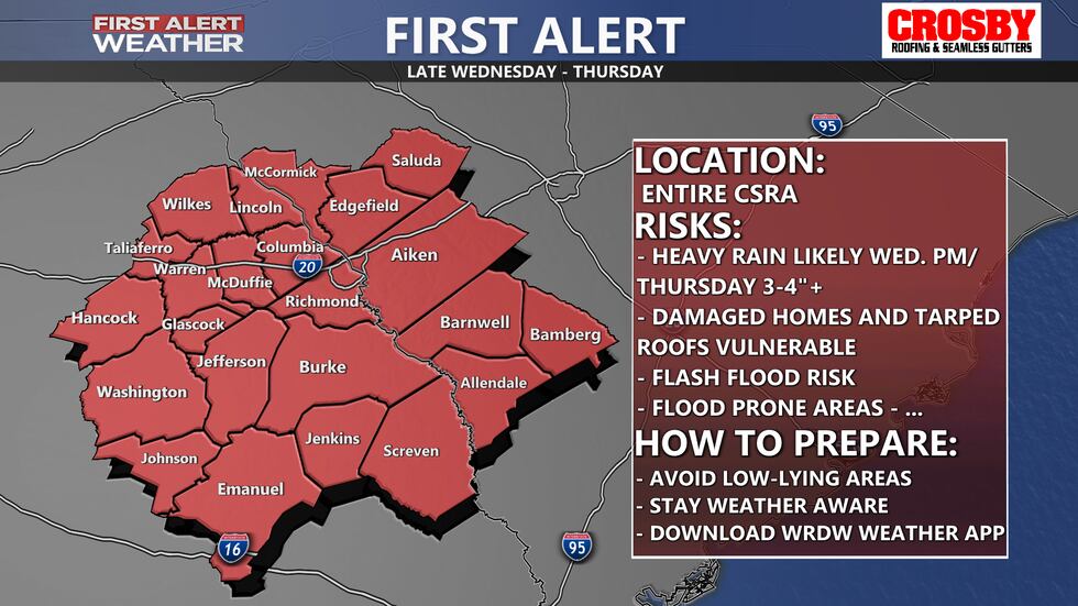
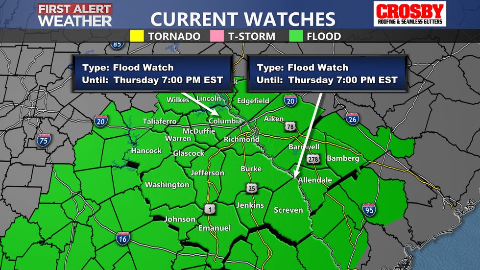
A FLOOD WATCH has also been issued until 7 PM Thursday. Flash flooding will remain possible through tomorrow.
Highs and lows will continue to remain above average all week in the upper 70s with mornings lows in the 60s. There is no major air mass change expected behind this front with mid-70s still expected by this weekend for highs and lows in the mid to upper 50s.
We are tracking Hurricane Rafael. This system is expected to mainly impact Gulf Coast states at this time, staying away from the CSRA. Any local impacts from Rafael will come in the form of tropical moisture today and tomorrow as that moisture interacts with the cold front. Keep it here for updates as things continue to develop.
Copyright 2024 WRDW/WAGT. All rights reserved.


