Daily forecast | From First Alert Meteorologist Mikel Hannah-Harding
Wet weather likely Thanksgiving Day. Our next COLD BLAST arrives by this weekend!
AUGUSTA, Ga. (WRDW/WAGT) - Clouds return this evening into tonight with lows staying in the 50s as humidity increases. Isolated showers look possible after midnight before daybreak Thursday.
Higher rain chances move in Thanksgiving morning accompanied by a cold front. This front will bring us a low-level marginal risk (1/5) for severe weather according to the Storm Prediction Center. High temperatures will be in the upper 60s and low 70s on Thanksgiving Day with rain expected to last into the early afternoon. How long rain will last will be highly dependent on the speed of the front.
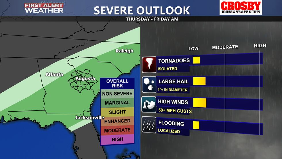
Our severe chances will also be dependent on the timing of this front. Models are split between an earlier arrival, which would be better for us and allow rain chances to move out quicker while limiting our severe threat, and a later arrival, which would result in greater chances for severe weather and longer lasting rainfall later into the day.
Dry and much colder than average weather returns Friday into the weekend. Highs will be in the 50s with lows near and below freezing. Sky conditions will be sunny to mostly sunny. Some of the coldest air so far this season is expected. Keep it here for the latest updates!
Copyright 2024 WRDW/WAGT. All rights reserved.


