Daily forecast | From First Alert Meteorologist Tim Strong
COLD WEATHER ADVISORY Friday 3 - 8 AM. Bitter cold temperatures return Friday and Saturday.
AUGUSTA, Ga. (WRDW/WAGT) - A brief seasonal warm-up today before another arctic front drops temperatures well below average Friday and Saturday. Colder-than-average temperatures will continue the next few days, but highs will be back in the 60s by Sunday and 70s possible early next week.
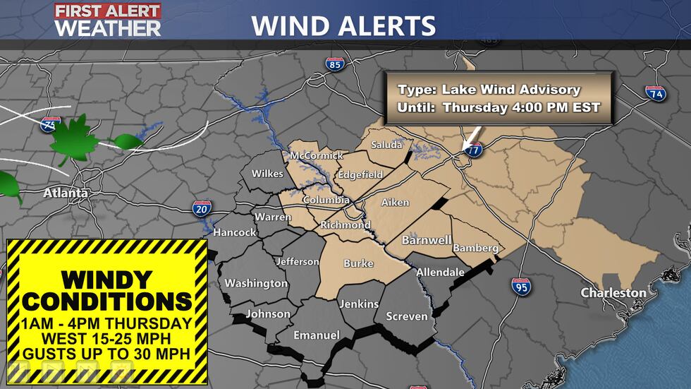
A lake wind advisory is in effect until 4pm this afternoon. It will be breezy with the front moving through. Wind will be out of the west between 10-20 mph with gusts up to 30 mph. Highs will be warmer today near 60°.
Behind the front, temperatures will drop to the mid and upper 20s by early Friday - wind chill will be a few degrees colder. Friday’s highs will be back in the upper 40s, and Saturday morning’s lows will be in the low to mid-20s. Saturday’s highs will be slightly warmer, in the mid-50s. Skies will be sunny to mostly sunny Friday and Saturday. With overnight temps and morning lows back in the 20s Friday and Saturday - make sure you’re protecting your people, pets, pipes, and plants! MORE INFO ON KEEPING THE 4 Ps SAFE
Sunday will feel more seasonal across the region as cold high pressure begins to retreat off the Southeast coast bringing back a more southwesterly wind direction. Morning lows will be in the low 30s and afternoon highs in the mid-60s. Partly cloudy skies are expected during the day.
Getting warmer early next week with morning lows above freezing in the 40s and 50s Monday and Tuesday. Afternoon will also be getting back close to 70. Another front is timed out to move through Wednesday of next week with the chance for showers ahead of the front Tuesday into Wednesday.
Keep it here for the latest updates!
Copyright 2024 WRDW/WAGT. All rights reserved.


