Daily forecast | From First Alert Meteorologist Mikel Hannah-Harding
Chilly weekend outlook. Sunny Saturday. Rain chances return Sunday into Monday.
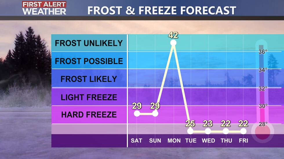
AUGUSTA, Ga. (WRDW/WAGT) - Overnight lows will drop into the upper 20s again for the start of our Saturday. Highs will only reach the lower 50s on both Saturday and Sunday afternoons. Isolated showers are possible Sunday afternoon/evening with the bulk of the rainfall moving in Monday morning with the main cold front.
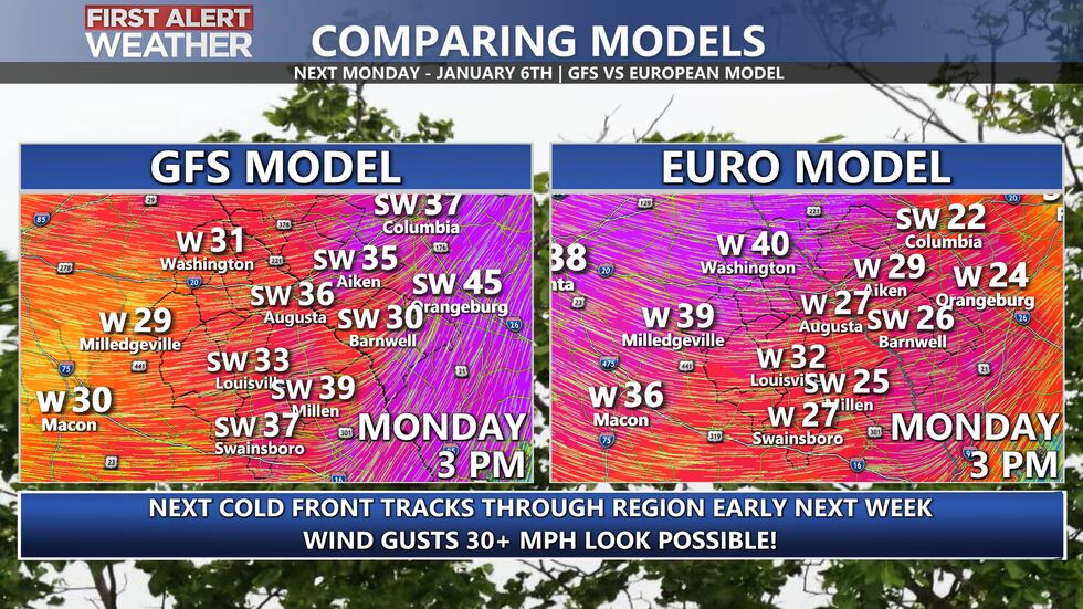
Our next rain maker shows up Monday with highs in the 50s. It will also be very windy behind our next front with 30+ mph gusts looking likely. Temperatures will actually fall through the afternoon from the 50s into the 40s. By Tuesday morning temperatures will be in the 20s.
We will feel the effects of the cold front that will push through by Tuesday. Temperatures will struggle to reach the upper 40s Tuesday afternoon and overnight lows will drop into the low 20s by Wednesday morning.
There is a chance for wintry precipitation next Friday but since it is 7 days away it is too early to have confidence in the forecast. Be sure you are receiving your forecasts from a reliable source. We will continue to monitor this but do not expect a specific impact forecast until the beginning of next week.
Keep it here for updates throughout the weekend!
Copyright 2024 WRDW/WAGT. All rights reserved.


