Daily forecast | From First Alert Meteorologist Tim Strong
FIRST ALERT WEATHER DAY TUESDAY AND WEDNESDAY. Tracking winter precipitation and extreme cold temperatures.
AUGUSTA, Ga. (WRDW/WAGT) - The bitter cold arctic air arrives today. Afternoon highs will only reach the upper 30s to near 40 degrees. Today looks dry for any Martin Luther King Jr. events happening around town - just very, very cold!
A Cold Weather Advisory is issued for some of our counties for wind chills below 15°. Winter weather also looks likely between Tuesday and Wednesday next week.
Tuesday we can expect an area of low pressure to form in the western Gulf of Mexico and to our south Tuesday afternoon into Tuesday night. Temperatures should be cold enough through most of our atmosphere to mainly snow, but the southern CSRA could have a better chance for a wintry mix of flakes, sleet, and freezing rain.
We have issued a First Alert Weather Day for Tuesday afternoon through Wednesday due to this snow potential and also for the dangerously cold temperatures headed our way.
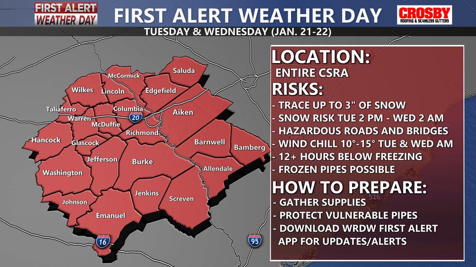
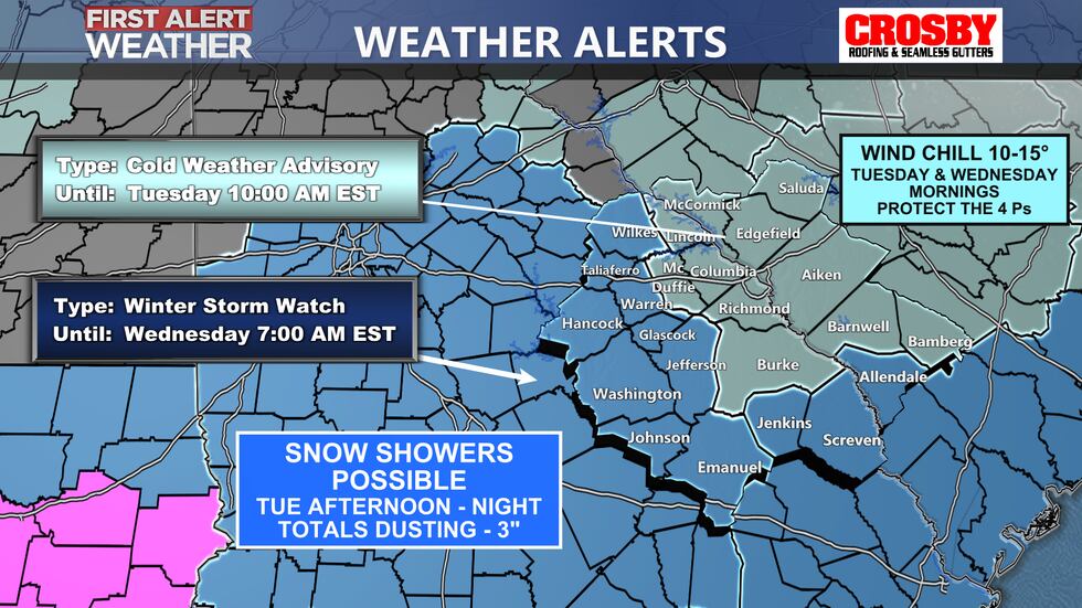
Snow is expected to fall starting late Tuesday afternoon. Travel can become hazardous very quickly as temperatures will start to drop well below freezing. Moderate snowfall will continue throughout the overnight hours and into early Wednesday morning.
Wednesday we will struggle to get above freezing and will likely only see a few hours just above the freezing mark. This will not be enough time for the roadways to thaw out. Any snow/ice that does melt will refreeze overnight Wednesday making Thursday morning travel potentially dangerous as well.
Snowfall totals are predicted to be between 1-3 inches and ice accumulation will be below 0.1″ for most of the CSRA.
A First Alert is in effect for dangerously cold temperatures Thursday morning with the chance of refreezing.
* Please prepare now for possible travel impacts and power outages.
Keep it here for the latest updates!
Copyright 2025 WRDW/WAGT. All rights reserved.


