Daily forecast | Latest From The First Alert Meteorologist Mikel Hannah-Harding
Rain chances return Wednesday. Getting colder as we finish off the week.
AUGUSTA, Ga. (WRDW/WAGT) - Much colder temperatures build in this week for afternoon highs with well below freezing morning lows by the end of the week. Winter is still here!
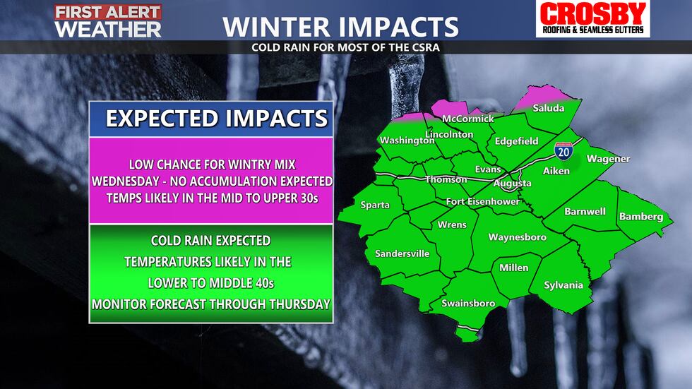
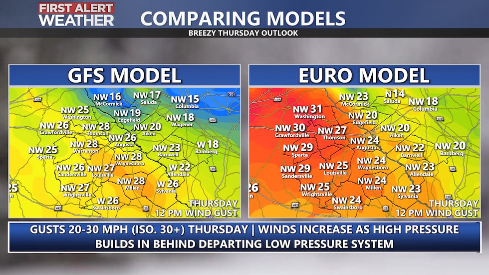
Rain returns Wednesday with wedge conditions expected. This will keep temperatures in the low to mid 40s most of the day. Showers are looking to clear out late afternoon leading into a dry end of the work week. Lows will be in the 30s Wednesday night/Thursday morning. Winds become breezy by Thursday as high pressure builds in with gusts 20-30 mph possible out of the northwest.
Wintry precipitation looks to stay north of most of the CSRA Wednesday into Thursday but a brief period of mixed wintry precipitation could be possible in our northern counties depending on the ultimate track of a Gulf coast low pressure system to our south and east. Right now, the freezing line looks to stay in upstate South Carolina and Georgia. Sleet and maybe a few flurries would be possible at most for any areas that get cold enough.
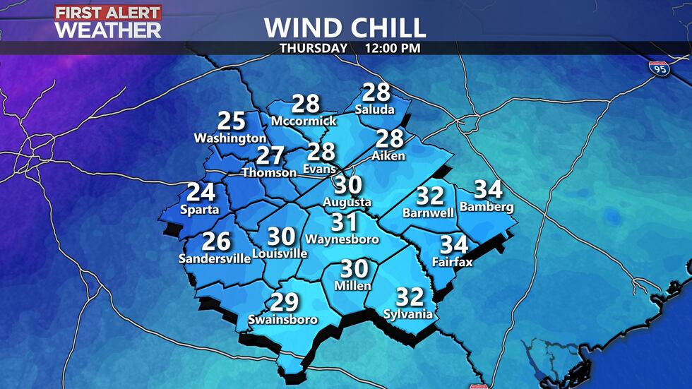
Thursday also looks dry with partly cloudy sky conditions and temperatures below average in the upper 40s for highs. Wind chill values will be in the 20s and 30s all day due to gusts 20-30 mph. Mornings become frigid heading into Friday with lows in the upper teens and low 20s possible!
Overnight low temperatures will be well below freezing on Friday and Saturday morning. Sky conditions look to stay mostly sunny to partly cloudy both days. Highs Friday stay in the 40s with both Saturday and Sunday in the 50s. Isolated showers look possible. Keep it here for updates!
Copyright 2025 WRDW/WAGT. All rights reserved.


