Daily forecast | From First Alert Meteorologist Tim Strong
First Alert Monday - Severe storms possible. Elevated fire risk today - very dry air and drought conditions persist.
AUGUSTA, Ga. (WRDW/WAGT) - FIRST ALERT has been issued for next Monday (3/31) for the risk of severe storms producing damaging winds, large hail, and even isolated tornadoes. Make sure you’re staying updated on the forecast. An elevated fire risk is still in place today for relative humidity below 30% and very dry fuels on the ground. DON’T BURN! Staying dry Friday and Saturday before storms move in Sunday and Monday.
Sunny and warm today with warm highs near 80 by Friday. Clouds return Saturday, but we should be dry most of the day with highs in the low 80s. Showers and storms will be possible Sunday as our next system moves through the region. Most storms Sunday should stay below severe levels, but lightning and small hail will be possible. Highs will stay warm on Sunday in the low 80s.
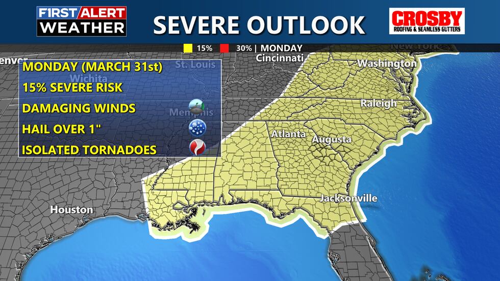
FIRST ALERT: We have issued a First Alert for Monday, 3/31 for the chance for strong to severe storms. This is 5 days out so as we get closer to time we will have a better idea on the time these storms will arrive, but for now, we are monitoring a severe threat. Keep it here for updates!
Copyright 2025 WRDW/WAGT. All rights reserved.


