Daily forecast | From First Alert Chief Meteorologist Riley Hale
Scattered strong storms through sunset. Staying stormy Thursday. Slightly drier outlook for weekend.
AUGUSTA, Ga. (WRDW/WAGT) - Low severe weather risk today for gusty winds and small hail. Storms continue Thursday, but slightly drier conditions expected by the weekend. Warmer than average weather will continue through the weekend.
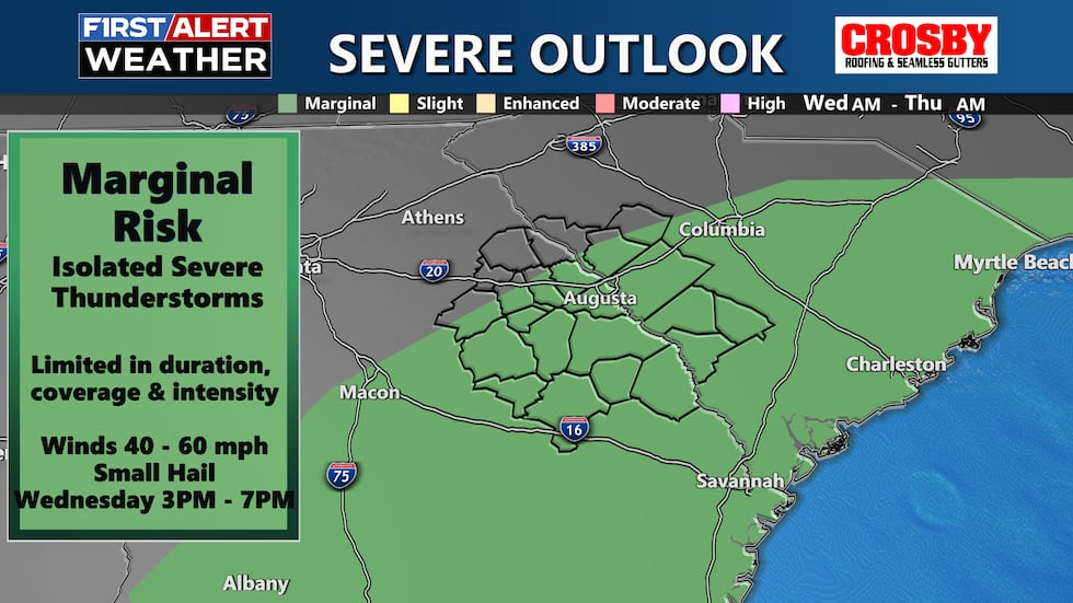
Storms look likely today and Thursday as a front moves in and stalls over the region. Heavy rain and lightning are the main concerns with storms, but an isolated stronger storm producing strong gusts and hail can’t be ruled out. Highs will stay warm in the mid-80s. Rain chances are highest Wednesday in the afternoon/evening. Showers will be likely Thursday morning then scattered storms are possible by the afternoon.
Only isolated showers and storms are expected Friday as the stalled boundary from Wednesday and Thursday becomes less evident from days of mixing. Highs will stay above average in the mid-80s.
Isolated storms will be possible Saturday as another front moves into the region, but I wouldn’t cancel outdoor plans yet. Looking dry by Sunday as the front pushes south and east of the CSRA. Highs will be in the upper 80s Saturday and low 80s Sunday. Keep it here for updates!
Copyright 2025 WRDW/WAGT. All rights reserved.


