Daily forecast | From First Alert Meteorologist Emily Acton
Low humidity for the first part of the weekend. Storm chances return by late Saturday into Sunday.
AUGUSTA, Ga. (WRDW/WAGT) - The “cooling” trend continues Saturday with highs in the low to mid-80s and mostly dry conditions. The chance for a few showers/storms arrives by late Saturday night into Sunday. Morning lows will be in the upper 50s Saturday and near 60 Sunday.
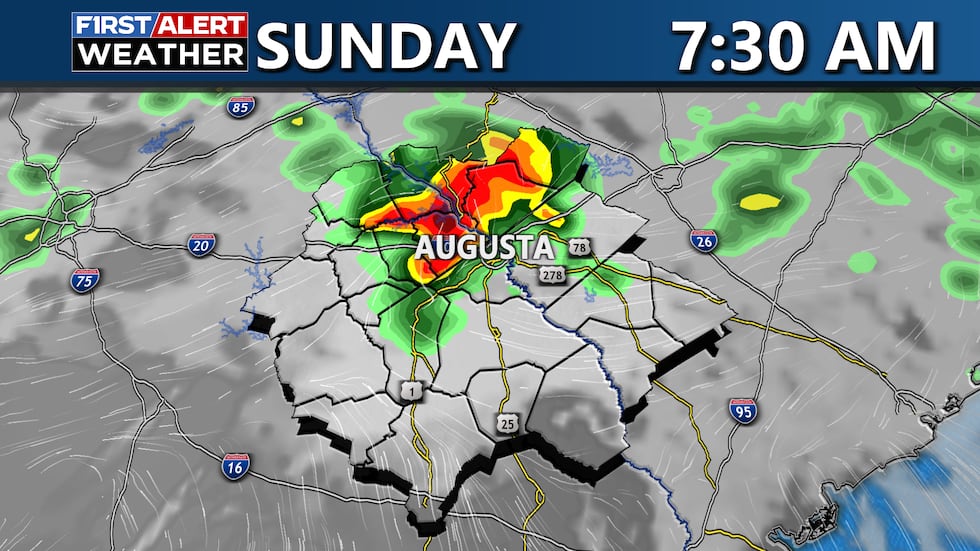
Sunday highs will be warmer in the mid to upper 80s. There is a low marginal threat (1/5) for severe storms late Saturday through Sunday night. Any severe storms that form will be capable of producing damaging wind gusts up to 60 mph, hail up to 1″ in diameter, and locally heavy rainfall. Dangerous cloud-to-ground lightning could also be a hazard.
Storm chances continue into Memorial Day Monday. A front will be stalling near the CSRA and bring the chance for scattered storms, mainly in the afternoon. Highs will be warm in the upper 80s.
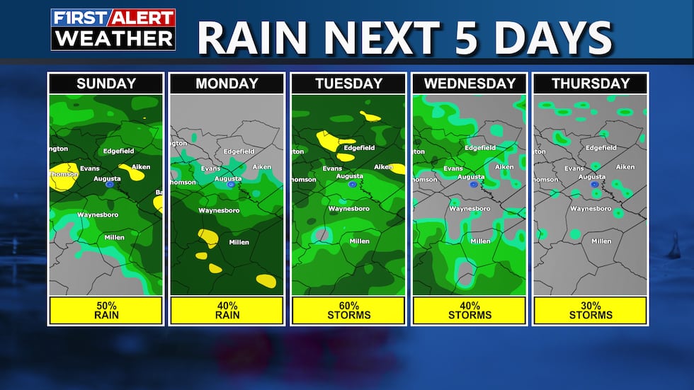
Scattered storm chances are expected to extend into the middle to end of next week with the front hanging around the region. Keep it here for the latest updates!
Copyright 2025 WRDW/WAGT. All rights reserved.


